Hangman Island
| Hangman Island | ||
|---|---|---|
| Gewässer | Boston Harbor, Atlantischer Ozean | |
| Geographische Lage | 42° 17′ 25,4″ N, 70° 58′ 13,2″ W42.2903768-70.9703256Koordinaten: 42° 17′ 25,4″ N, 70° 58′ 13,2″ W | |
| ||
| Fläche | 1,2 ha | |
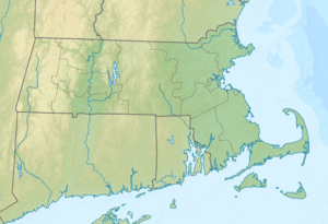

Hangman Island (auch Hayman’s Island, Hangamn Island oder Hangmans Island) ist eine Insel im Boston Harbor. Sie liegt in der Quincy Bay 7 mi (11,3 km) vom Bostoner Stadtzentrum entfernt auf dem Gebiet des Bundesstaats Massachusetts der Vereinigten Staaten. Hangman Island verfügt über eine dauerhafte Fläche von ca. 0,45 Acres (0,2 ha), die durch ein Watt je nach Tidenhub temporär um bis zu 5,5 Acres (2,2 ha) vergrößert wird. Die Insel gehört zu Quincy und ist Teil der Boston Harbor Islands National Recreation Area.
Hangman Island ist geologisch gesehen ein Aufschluss aus Granit und Schiefer. In der Kolonialzeit wurde die damals noch wesentlich größere Insel als Steinbruch genutzt.[1]
Einzelnachweise
- ↑ Island Facts: Hangman Island. National Park Service, abgerufen am 25. Mai 2014 (englisch).
Weblinks
- Hangman Island. In: Geographic Names Information System. United States Geological Survey, United States Department of the Interior; abgerufen im 1. Januar 1 (englisch).
V
Inseln der Boston Harbor Islands National Recreation Area Zum Schutzgebiet gehörende Inseln und Halbinseln, sortiert nach zugehöriger Stadt
| Boston | Calf Island • Gallops Island • Georges Island • Great Brewster Island • Green Island • Little Brewster Island • Little Calf Island • Long Island • Lovells Island • Middle Brewster Island • Nixes Mate • Outer Brewster Island • Rainsford Island • Shag Rocks • Spectacle Island • The Graves • Thompson Island |
| Hingham | Bumpkin Island • Button Island • Langlee Island • Ragged Island • Sarah Island • World’s End |
| Hull | |
| Weymouth | Grape Island • Sheep Island • Slate Island • Webb Memorial State Park |
| Winthrop | Deer Island • Snake Island |
| Quincy | Hangman Island • Moon Island • Nut Island • Raccoon Island |
Massachusetts Department of Conservation and Recreation • Urgeschichte der Boston Harbor Islands


